There are different route grades used by certain UK national parks, which are based on gradients and surface conditions you're likely to encounter on your journey. Make sure you have an in-depth look at which route is the most suitable for you:
- For all: Suitable for everyone - This refers to pushchairs and people who operate their own wheelchairs. Gradients will be low, no more than 1:10. The ground surface is most likely to be tarmac/smooth compacted stone with a diameter of 10 mm or less, and the path width will be a minimum of 1 metre with passing places.
- For many: Suitable for assisted wheelchair users and families with more robust, all-terrain type buggies. Newly built gradients can be up to 1:8, but existing gradients are no more than 1:10. Path surface will consist of a rougher stone of 4 cm diameter or less.
- For some: Suitable for strong and confident wheelchair users and sometimes for off-road mobility scooters. Gradients will range between 1:10 to 1:8, and where there are steep slopes you will find handrails and improved surfacing. You may find low steps/breaks in the surface that are up to 10 cm in height, the stone surface materials may be up to 10 cm in diameter and it will be rougher.
Source: Lake District National Park
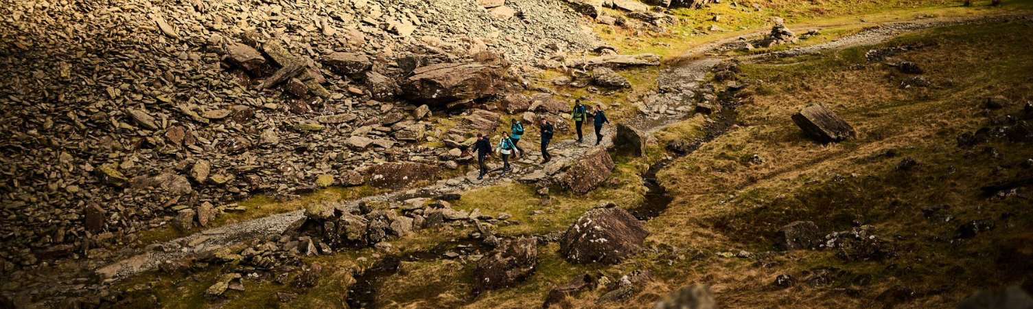
1. Lake District
Perhaps one of the most popular national parks in the UK, the lake district in the north west of England offers unparalleled views of scenic lakes and mountains, with the highest mountains in the region being Scafell Pike, Helvellyn & Skiddaw. The region is revered by outdoor and car enthusiasts alike, thanks to the stellar combination of winding roads and inspiring scenery. It's a real gem and is an absolute must-visit if you've never been before. Don't forget your camera!
Kentmere:
- Distance: 2.3 miles (3.75km)
- Route type: Tarmac road with views of the high peaks.
- Starting point: The gate at end of Hollins Lane
- Website
Tarn Hows:
- Distance: 1.8 miles (3km)
- Route type: A circular walk along the tarn
- Starting point: Begin at the main car park.
- Website
Broughton Railways:
- Distance: 2.8 miles (4.5km)
- Route type: An easy walk along a disused railway line to Woodland valley, with stopping points throughout
- Starting point: Either Market Square or the railway in Broughton in Furness
- Website
Staveley Riverside:
- Distance: 0.8 miles (1.5km)
- Route type: A flat level path alongside the River Kent and some tarmac road.
- Starting point: Staveley Mill Yard.
- Website
2. Peak District
Whilst the Peak District garnered it's fame from cave systems, it's now a popular destination for hikers thanks to the sheer breadth of the landscape and the trails which lay within. The Peak District is in northern England and there are a few viewing points dotted about which you can take a quick break to admire on your car journey there. On the way back, it's worth taking the scenic route via Saddleworth Moor for a view of the local reservoirs and a full panorama view of a historic part of the region.
Tideswell Dale:
- Distance: 2 miles (3.2km)
- Route type: Flat path followed by a walk on the road.
- Starting point: Tideswell Dale Car Park, via the B4049, south from Tideswell or from the A6 Buxton to Bakewell Road.
- Website
Coombs Dale:
- Distance: 2 miles (3.2km)
- Route type: A track next to playing fields
- Starting point: Stoney Middleton Playing Fields off the A623 near Calver crossroads
- Website
Manifold Way:
- Distance: 1.7 miles (2.8km)
- Route type: A road following the disappearing stream.
- Starting point: Wetton Mill in the Manifold Valley
- Website
Parsley Hall (near the cycle hire):
- Distance: 2.4 miles (4km)
- Route type: Flat route, alongside former railway lines.
- Starting point: Parsley Hay Car Park, via the A515 Buxton to Ashbourne Road
- Website
3. South Downs
Aptly named, South Downs is on the south-eastern coast of England. Here, you'll find vast chalky hills and a stunning view of the British coast. There are plenty of landmarks to visit around South Downs, including the Long Man of Wilmington and various war memorials, it's a great holiday location for history buffs.
Seven Sisters:
- Distance: 1.3 miles (2km)
- Route type: Flat footpath with fully accessible gates along the way.
- Starting point: The southern side of the A259 opposite the Seven Sisters Country Park Visitor Centre at Exceat, Seaford, East Sussex BN25 4AD.
- Website
Seaford Head:
- Distance: 0.6 miles (1km)
- Route type: The route is wide and it has surfaced paths.
- Starting point: South Hill Barn car park, Seaford Head, East Sussex BN25 4AR
- Website
Bramber:
- Distance: 2.2 miles (3.6km)
- Route type: Flat terrain along the water, suitables for ‘all- ablilities’.
- Starting point: Car park on The Street, Bramber, West Sussex, BN4 3WE
- Website
Mill Hill:
- Distance: 0.3 miles (0.5km)
- Route type: The circular route takes you through chalk grassland, a woodland copse, with stopping points throughout. The track has various viewpoints in the woodland area.
- Starting point: Mill hill upper car park
- Website
4. Cairngorms
Cairngorms is within the Scottish highlands, it's a consistently cold area throughout most of the year and as such it's subject to frequent snow. Whilst you'll need to wrap up warm, on your visit you'll encounter uncommon species of birds and some of the tallest mountains in the entirety of Scotland.
Nethy Bridge:
- Distance: 0.75 miles (1.2km)
- Route type: A purpose built circuit suitable for ‘all-abilities’ with a mixture of tarred paths, packed whindust and boardwalk surfaces.
- Start point: Either from Community Centre (follow sign for car park) in centre of Nethy Bridge or from Birchfield Court off B970. Once on route follow signs for The Birch Wood.
- Website
Aviemore, Craigellachie:
- Distance: The trail is 0.5 miles (0.8 km). However, to get to the start from the main road (Grampian Road B9152) in Aviemore is a further 0.5 miles (0.8km) each way
- Route type: A short circuit by a lochan in the stunning Craigellachie National Nature Reserve. Surfaced path with gentle gradients suitable for buggies and wheelchairs.
- Start point: From the B9152 at the southern end of Aviemore signposted for Nature Reserve, Youth Hostel and Catholic Church.
- Website
Glenmore:
- Distance: 3.5 miles (5.6km)
- Route type: A route that is relatively flat on firm paths or forest tracks. You will pass some fantastic pinewood in a dramatic mountain pass. Suitable for scooters and buggies, however it’s quite a long way so make sure your batteries are fully charged and you have a strong partner to push.
- Start point: Glenmore Forest Park Visitor Centre (disabled parking available in upper car park) or from Glenmore Lodge.
- Website
Laggen:
- Distance: 2 miles (2.7km)
- Route type: Flat route that runs between Gorstean and Wolftrax Car Park. Suitable for wheelchairs, buggies and scooters. This is also a well known mountain bike route so be aware of them.
- Start point: Wolftrax Car Park off the A86 near Laggan.
- Website
What to take to a National Park?
As you wander your way around one of these routes, it's likely that you'll have access to lots of the local amenities for things like food, drinks and an accessible toilet. However, it's worth bringing along some of the essentials to be prepared in case of any rain or cold weather. Here are some of the things we'd recommend:
- Walking Boots
- Waterproof Jacket
- Fleece
- Backpack
- Waterbottle
- A Map/Waterproof Map Case
So there you have it, a nice mixed bag of wheelchair friendly walks dotted around the UK. Whether you prefer the tranquil coast or the seclusion of the forest, there's an accessible route which everyone can enjoy. For more content like this, check out some of our other walking guides.